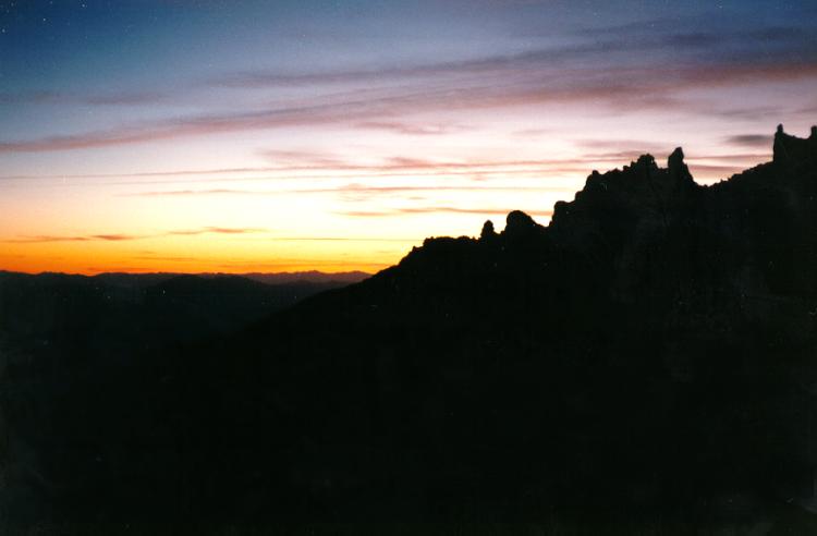
Sunset from camp at Helen Lake.
Sunset from camp at Helen Lake.
Shasta is a pretty formidable peak, but is doable by most people in good shape via the route up Avalanche Gulch. The key, in my opinion, is not to try to do it in one day. That requires leaving the Bunny Flat parking lot at 3 am, which means you'll have limited sleep and be even more succeptible to altitude sickness. It also puts you up near the summit in a tired state right about the time storms can pop up out of nowhere. The downside of a longer trip, of course, is that you must carry much more gear. Note that starting in 1997, there is a $15 per climber use fee that gives you 3 days. This can be paid for by self registration at the trailhead. For $25 you can buy a 12 month pass that also covers parking at the other trailheads (normally $5/day). However you must go to the Ranger Station to get this pass. So the basic program is to drive up Saturday morning at arrive by midday. Hopefully you will have packed already, and thus won't take till 3 like we often do. You should have basic backpacking gear with a couple important items:
 If it is early in the summer, the snow may reach down to the parking lot
at Bunny Flat. But by the end of the summer, the snow level may rise 3
thousand feet, so first day travel time will vary. Too late in the season
the Gulch will be a scree fall - at this point you should wait till next
year. Too much rockfall, not much fun.
If it is early in the summer, the snow may reach down to the parking lot
at Bunny Flat. But by the end of the summer, the snow level may rise 3
thousand feet, so first day travel time will vary. Too late in the season
the Gulch will be a scree fall - at this point you should wait till next
year. Too much rockfall, not much fun. The Trail - Day 1
Bunny Flat to Horse Camp: This stretch is a very gradual incline and a
good for getting used to the weight of the backpack. A couple areas are
steep, but mostly it's pleasant. If snow covers the trail, however,
you'll have wanted snow shoes by the time you're done. Horse Camp has a
lovely cascading waterfall spring, which I have only seen in the dark (was
being built that weekend- Tom and I even helped lay a heavy piece). Fill
your two quarts here. (You can get away with just one quart at the
parking lot)
Horse Camp to Helen Lake: The exertion level jumps up now. The one big downside to an afternoon start is that the snow here will be soft from the day's sun. The first part is along a rock path (Oberman's Causeway) that cross a meadow, then shoots up the first face. In snow season you may be able to just go straight up. Follow the tracks/trail! At 10,400, Helen Lake is about the midpoint and the last camp site for a long way. Depending on the season, you may be pitching on snow or dirt. In either, take care to stake down the tent and if possible build rock walls (cairns) about the site. A few weeks ago high winds at Helen destroyed many tents, and in one case blew away an occupied one. When gathering snow to melt for the summit climb, avoid the red tinged patches, which contains a nasty snow algae.
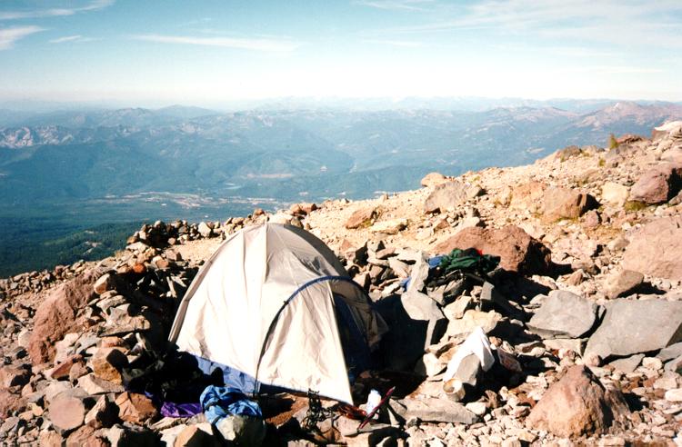
Two different forms of camping at Shasta

The Trail - Day 2
 Helen Lake to Red Banks: This is the nasty part- a long
2100 foot ascent of Avalanche Gulch. If it's after 8am when you leave
Helen Lake, you won't make it to the top in time, so don't bother.
Another reason to leave early is that this place got its name for a
reason. The earlier you start, the firmer the footing. By mid afternoon,
the snow gets softer and harder to walk up. There is no longer a true
trail, but there may be an obvious route that everyone is taking. Midway
up you'll reach the Heart where you'll want to veer to the right. This is
the steepest part of the day, reaching 35 degrees.
Helen Lake to Red Banks: This is the nasty part- a long
2100 foot ascent of Avalanche Gulch. If it's after 8am when you leave
Helen Lake, you won't make it to the top in time, so don't bother.
Another reason to leave early is that this place got its name for a
reason. The earlier you start, the firmer the footing. By mid afternoon,
the snow gets softer and harder to walk up. There is no longer a true
trail, but there may be an obvious route that everyone is taking. Midway
up you'll reach the Heart where you'll want to veer to the right. This is
the steepest part of the day, reaching 35 degrees.
 Red Banks: These start at about 12,500. Tom and I went
straight up it, but there is also a trail that goes around to the right
side. Late in the season when we were there, it was very icy within the
narrow valleys. Proceed with caution. It feels insanely pleasant when you
clear this very steep section. After this, you're only fighting time and
altitude the rest of the way.
Red Banks: These start at about 12,500. Tom and I went
straight up it, but there is also a trail that goes around to the right
side. Late in the season when we were there, it was very icy within the
narrow valleys. Proceed with caution. It feels insanely pleasant when you
clear this very steep section. After this, you're only fighting time and
altitude the rest of the way.
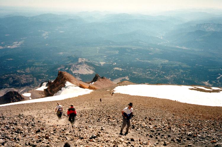 Misery Hill: When you clear Red Banks, you are at a plateau at the base
of Misery Hill, so named because people mistake it for the summit. I
didn't like it because what you think is the top of MH is actually only
half way up this section. Late in the season, this area will probably be
dirt and you can leave your ice gear at the base. It's not a hard hill
aside from the fact that you're breathing pretty thin air, and the surface
may be getting close to scree.
Misery Hill: When you clear Red Banks, you are at a plateau at the base
of Misery Hill, so named because people mistake it for the summit. I
didn't like it because what you think is the top of MH is actually only
half way up this section. Late in the season, this area will probably be
dirt and you can leave your ice gear at the base. It's not a hard hill
aside from the fact that you're breathing pretty thin air, and the surface
may be getting close to scree.
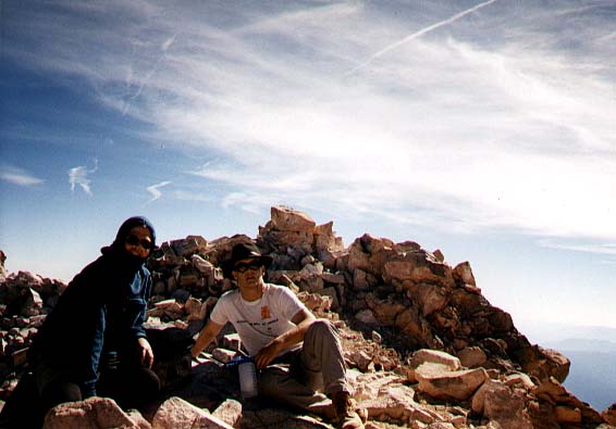
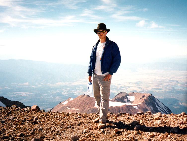
Summit: The top of Misery Hill is about 14,000, leaving you only a couple hundred feet short of the summit. You go a short flat distance to the base of the split summit - the true one is on the right! Then it's just a scramble to the top, with an alarming bit of exposure on the far side. The summit itself is only 5 by 10 feet, but there is a bit more space and protection from the wind just below. Take a breather, and get your pictures. Don't forget to sign in! If you still have time and you're not feeling the effects of altitude sickness, go to the other edges of the summit plateau and look down on the other faces of the mountain.
The descent: Unfortunately, the same steepness that made coming up tricky makes going down the same. Be it dirt or snow, you have to go slowly. As I said before, don't glissade if you don't know how to stop - it's too damned steep on Avalanche Gulch for that. Every year a number of people glissade with their crampons on - a sure way to break your ankles. Don't make their mistake. Later in the summer, the bobsled run (err, glissade path) becomes 3 feet deep and hard packed. Even if you know what you're doing, glisadding isn't always the right course. Plunge step if the snow is soft, put on the crampons if it's icy or packed.
Other Resources:
Attempt #5 - success a week after the Bolam trip, using the traditional Gulch route with buddies from Gamers.
Bolam Glacier - my recent attempt (#4) to climb on the north side of Shasta. Turned at 12,400, but definitely a learning experience for climbing.
Early attempts - my first three tries done in 95-96 using the route described above.
Rangers' Conditions Report: - covers both weather and state of the various routes for the peak. SADLY, Rangers keep moving their pages. Where is it?
Shasta Mountain Guides - One of a few guide outfits that does basic and advanced training. I took their two one day courses on primary mountaineering skills. My review of these sessions.
The Fifth Season - the main mountaineering shop in town.
Climbing Mt. Shasta, by Steve Lewis. This book covers the Avalanche Gulch route described above. More detail and pictures, but I'm not in complete agreement with some of the ice ax techniques shown.
GPS Coordinates on the mountain.